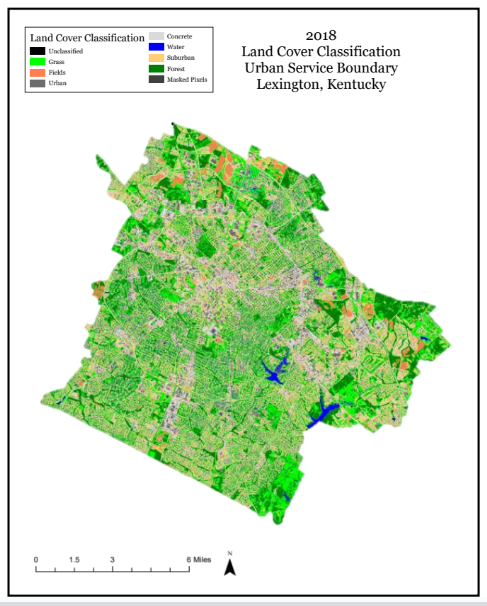
Analyzing Land Cover Change in Lexington’s Urban Service Boundary
Methodology:
Comparison Areas:
- Lexington, Kentucky Urban Service Boundary
- 5-mile Buffer Zone Outside Urban Service Boundary
Data Collection & Time:
- Sentinel-2 Satellite Imagery
- May 20, 2018 & April 18, 2023
- Lexington, KY Urban Service Boundary
Software:
- ENVI
- ArcGIS Pro
Processing:
- Create ROI Training Samples
- Perform SAM Image Classification
- Clipped Urban Service Boundary and Buffer Boundary to Raster