Comparative Flood Vulnerability Assessment in Boone and Waynesville, North Carolina: Integrating Floodplain Data, Land Use, and Spatial Analysis
Background
Study Area:
- Boone, NC
- > 3000 ft. elevation
- Appalachian State Univ.
- High Country regional anchor
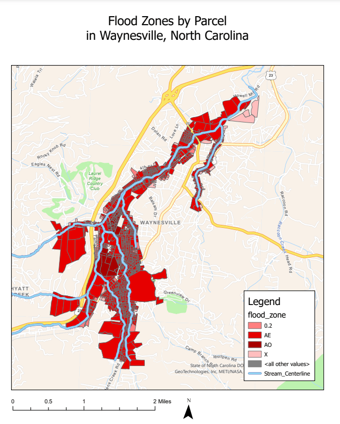
- Waynesville, NC
- Interstate 40
- Great Smoky Mountains NP
- Near WNC regional anchor, AVL
Geography & Demographics:
- Mountainous
- Rural
Historical Flooding:
- Boone →
- 1940, 2017
- Waynesville →
- 1940, 2004, 2021
Methods
Data Collection:
- Boone, NC Flood Areas
- Waynesville, NC Flood Areas
- Watauga County Parcels
- Boone, NC Zoning Polygons
- Haywood County Parcels
- Waynesville, NC Zoning Polygons
Data Analysis:
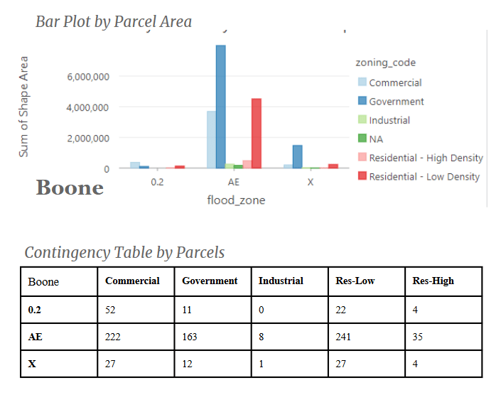
- Spatial Join
- Summary Statistics
- Chi Squared Test
Softwares:
- ArcGIS Pro
- PyCharm


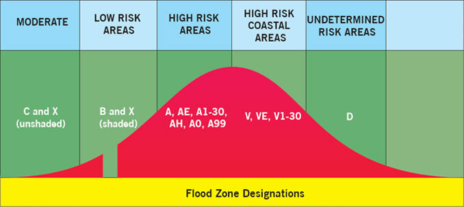
Flood Zones →
- AE
- AO
- 0.2
- X
Zoning Codes →
- Residential – Low Density
- Residential – High Density
- Commercial
- Government
- Industrial

Data Analysis

Results
Discussion
Findings:
- Certain zoning classifications were disproportionately associated with specific flood zones.
- Waynesville’s lower p-value may indicate a more significant relationship between these variables as compared to Boone.
Limitations:
- Mismatched Zoning Classifications between the two cities.
- Small sample sizes
- Limited statistical analysis options
